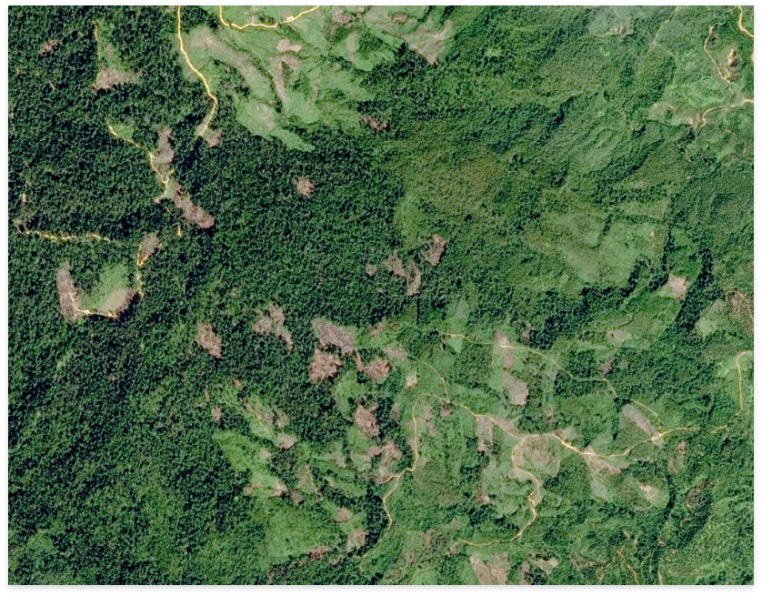
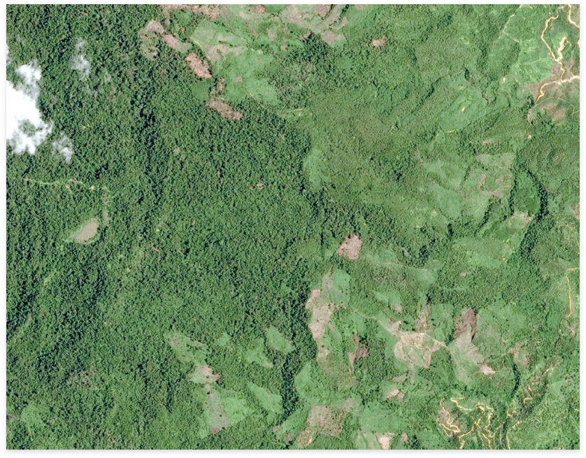
Starling is an advanced remote sensing solution to curb deforestation and meet sustainable forest management. Starling delivers forestry analytics to support people to curb deforestation. With Starling, users can access a digital service that provides accurate land cover maps and forest cover change data. Enhanced with users’ supply chain information, it enables them to take action, towards a more sustainable policy and forest management strategy. This technology uses higher-resolution optical and radar satellite imagery to cater to unbiased monitoring of change in forest cover. The monitoring solution comprises a base map, forest monitoring, and a dashboard.


STARLING
KEY FEATURES
KEY APPLICATIONS


GO MONITOR
SURVEILLANCE ON DEMAND
Go Monitor aims to deliver products for reliable and timely surveillance. Besides having revisit capacities, its design suits best for professionals who require accurate and reliable terrain information. Irrespective of the inaccessibility of a site, Go monitor ensures timely and regular imagery. Independent of the weather conditions, it shall deliver any change in information. Thus, enabling the users to monitor and understand the environment for their daily operations. The report shall be useful for day-to-day business operations, assets, impact on the natural habitat, security, emergency, and strategic surveillance.
KEY BENEFITS
Go Monitor validates the access to the broadest optical and radar satellite constellation. Therefore, it becomes easier to avail of the benefits. Besides relying on the team of application experts such as geologists, Micronet Solutions guarantees the following benefits:


MARITIME SURVEILLANCE
More than 90 percent of the global goods trade occurs through seas. More than 70 percent of transportation of global crude oil occurs through seas. In simple words, the shipping traffic is rising at an increasing rate. With this, their arrises a tremendous pressure on the world’s oceans and its security. Besides more likelihood of accidents, there are dangers relating to environmental damage threat of piracy, crime, and terror. Facts reveal that illegal maritime activities like illegal fishing, drug trafficking, illegal immigration, and weapon movement are continually rising. Maritime surveillance is vital domain to ensure an appropriate response towards any situation developing relatively to marine safety and security. Therefore, by all available means, active surveillance is forewarned and forearmed. At present, monitoring takes place through surface and air platforms. However, the pressure from illegal activities occurring in the international and national waters leads to a higher demand for reactive imagery.
DEPENDABLE MONITORING
Airbus Defence and Space uses the constellation combining the radar and optical satellites to provide comprehensive monitoring services. These services enable an efficient answer for all maritime threats by building a meaningful solution for subtle detailing, wide-coverage, intensive monitoring, premium reactivity, and positive interpretation response.
Airbus Defence and Space can activate and combine appropriate satellites if:
MONITORING SERVICES
Micronet Solutions provides reliable services supporting maritime safety. Additionally, it is possible to provide factual information by using unique access to optical and SAR satellite imagery. The maritime monitoring services support shipping and insurance companies, national and private security forces, oil, gas, and mining organizations, as well as the environmental protection agencies. It is thus ensuring the safety and efficiency of maritime activities globally.
RELIABLE SERVICES SUPPORTING MARITIME SAFETY
Airbus Defence and Space supports shipping and insurance companies, OGM firms, National Authorities private security forces and environmental protection agencies with timely and accurate information to ensure the safety and efficiency of maritime activities around the globe.


STACK INSIGHT
A NEW AND REVOLUTIONARY REMOTE VOLUME CALCULATION AND SURVEYING TOOL
Stack Insight aims to make volume calculations easier, cheaper, and more precise. At present, it is the latest satellite-based change detection and volume calculation service available in the market. It is thereby eliminating much of the cost as well as the risk that emerge with ground surveying. Over the years, the comparison of the accuracy of LIDAR against the Stack Insight for volume calculation reveals the worst error-rate as less than 2 percent. Altogether, Stack Insight is a highly accurate monitoring tool in comparison with the traditional ground and land surveying techniques. Stack insights is helps in providing space monitoring services and its mining monitoring system which allows us to provide mining monitoring service India.
CHANGE DETECTION
Micronet Solutions aims to develop applications for mining and civil engineering purposes. These services are useful for remote volume calculation and surveying tool of mined material. Additionally, it is also helpful in assessing changing volumes. Stack Insight utilizes Airbus Defence and Space’s high-resolution imagery products through its optical Pleiades constellation. Equally important is the high flexibility and the daily revisit capabilities of any area around the globe suitable for change detection.
VOLUMETRIC CHANGES
Micronet Solutions uses satellite-based solutions to provide a highly cost-effective route. Likewise, there are benefits from daily revisit capacities and fast acquisition irrespective of the location of the mine. We give accurate information through our Mining monitoring service India.
SURFACE MOVEMENT MONITORING
Micronet Solutions provides Surface Movement Monitoring (SMM) with millimeter precision as well as a high resolution from the space. Furthermore, the service aims to support and ensure security and effective performance in projects and activities. The input data from radar satellites provides individual baseline studies and long term monitoring requests. We are providing the best solution for surface movement monitoring service India.
Airbus Defence and Space can activate and combine appropriate satellites if:
MONITORING SERVICES
Micronet Solutions provides reliable services supporting maritime safety. Additionally, it is possible to provide factual information by using unique access to optical and SAR satellite imagery. The maritime monitoring services support shipping and insurance companies, national and private security forces, oil, gas, and mining organizations, as well as the environmental protection agencies. It is thus ensuring the safety and efficiency of maritime activities globally.
FEATURES AND BENEFITS


GLOBAL SEEPS
GLOBAL SEEPS SERVICES
Oil slick information is crucial for all oil exploration companies. This information helps to detect and monitor natural seepage and oil pollution on the surface of the ocean. The non-exclusive database of the offshore oil slicks is known as the global seeps, global seeps service India. The systematic screening of the world’s offshore basins reveals this data.
Global seeps data is a cost-effective resource that is useful in risk-ranking before beginning any new exploration. Besides, it is also essential for baseline oil pollution mapping. Global seeps cover approximately 60 million km2 of the offshore basins worldwide. This database always remains under overhauling. As a part of the rolling program, screening of new areas takes place. At the same time, there is overhauling of the existing spaces. Programming of new acquisition occurs according to the user request.
KEY BENEFITS
Archive and newly programmed satellite imagery are useful to define Global seeps. This database is definitive off-the-shell offshore oil slick detection database for the worldwide exploration industry.
Airbus Defence and Space hosts the dataset. This hosting of dataset makes the database available to multiple users across an organization using secure web access.
KEY APPLICATIONS
The key applications are:
Global Seeps screening uses satellite data acquired over the ocean to detect any oil slicks that may be present on the sea surface. The imagery is interpreted to identify slicks which may be sourced from natural seepage from hydrocarbon reserves.


FARMSTAR
FARMSTAR SERVICES, AN ADVISORY PANEL FOR CONTROLLING CROPS AND OPTIMISING YIELDS.
EXPERTISE DEVELOPED WITH ARVALIS AND TERRESINOVIA.
The world leader in geospatial information, Airbus Defence and Space provides their valuable experience to simplify agricultural operations. The farmstar services is an operating campaign that focuses primarily on the actions of the production chain. The production chain begins with image acquisition, followed by data processing, development of biophysical parameters, and lastly relevance as well as validation of advice. Finally, the subscribers receive information.
This decision support tool for agriculture has been providing its service since the past 15 years. Moreover, it is helping the farmers who are keen to optimize their yields and improvise the crop quality by nurturing them nicely and respecting the environment. The FARMSTAR services provides a complete range of advice by combining satellite images from our constellation with agronomical expertise.
FARMSTAR SERVICES BENEFITS
Real Decision Making Aid: The farming cooperatives send the farmer operators up-to-date data regarding the crops. The information is useful to determine the exact dosage of the products that plants may need. Using the correct dosage not only means saving money, but also being more environmentally responsible.
Sustainability: At several occasions, the United Nations has warned that nitrous oxide emissions from the use of nitrogen fertilizers can double by 2050. Thereby, there is an emerging need to minimize the loss of nitrogen in the environment occurring during crop cultivation. Moreover, it avoids farmers to take unnecessary tractor rides to reduce diesel consumption. Overall, reducing greenhouse gas emissions.
Gleaning data: Airbus Defence and Space uses its satellite fleet to study and integrate all useful sensors. Sensors from Pleiades 1 and 2, TanDEM-X, TerraSAR-X, NigeriaSat-X, UK-DMC-2, DEIMOS-1, Spot 6 and 7, Sentinel 2A, and Sentinal SB are useful. These satellites also provide data for other environmental concerns such as oil slick detection. This data generates only the highest quality advice that may be useful for leading insurance actors in developing products to cover weather perils. The primary objective here is to identify as well as quantify the production loss to compute accurate compensation for crop shortfalls.
BROADENING THE HORIZONS
Since 2015, Airbus Defence and Space began to explore the potentials from the sensors data that is onboard UAVs. This addition of UAV data can further lead to the optimization of crop diagnostics. Therefore, there is top-quality benefits delivery to the farmers.
DID YOU HAVE OTHER QUERIES ?
Micronet solution is there to support your business. We are ready to deliver.
